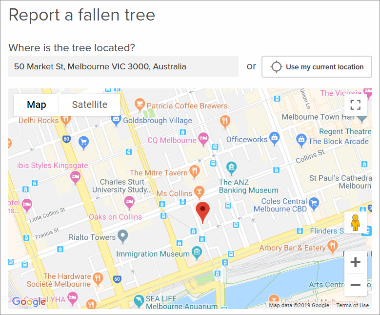
The Location field lets respondents provide address data, request location-specific information like waste collection, and report incidents like graffiti, potholes, or fallen trees.
The Location field is customizable in that you can choose to display a map using a connector to Google Maps or Esri ArcGIS, or to just display an address text box instead of using a map provider. To use Google Maps or Esri, you must have correctly configured the relevant connector.
Add a Location Field to Your Form
With your form open:
- Expand the Advanced fields and drag and drop the Location field into your form.
- Give it a field name and use the gear icon to open and edit the Location Field Settings.
- Choose whether it is a Required field and add a Description, if necessary.
- Use the Map provider drop-down menu to choose a Google Maps or Esri ArcGIS connector or leave it as None to only display the address text box to respondents.
- Uncheck the Display Use my current location? box to disallow this option.
- Save your form.
If you select None from the Map provider drop-down, respondents will be able to type their address into the text box or use their browser's location data to fill the field.
Google Maps and Esri ArcGIS connectors display a map on the field and have additional configuration options.
Google Maps Field Settings
Google Maps is only available as a location field map provider is an admin has configured the connector in Integrations.
When Google Maps is used, respondents can:
- View the map and drop a pin directly to mark a location.
- Use the location search box to enter an address and search for it to drop a pin, or select from the predictive results.
- Select Use my current location to drop a pin based on their browser location data.
The additional configuration settings for Google Maps are:
- Default map type: Choose if the map loads using the Default street view or using Satellite view. Respondents can still switch between the two on the live form.
- Center of map: Enter latitude and longitude coordinates to position the center of the map. These coordinates will also affect the predictive search, as locations close to the center will be favored in the results.
- Display map?: Check or uncheck Yes to choose whether the map is visible on the live form.
- Zoom level: Choose the zoom level for the map; a higher number means the map is zoomed in closer.
Esri ArcGIS Field Settings
Esri ArcGIS is only available as a location field map provider if an admin has configured the connector in Integrations.
Esri maps have the same functionality as Google Maps but you can also check respondent answers against data in your Esri ArcGIS account. You can use this data to:
- Validate that a respondent's location is within a geometric boundary or location list that you specify in Esri.
- Restrict answers to locations within the boundary or list.
- Present respondents with visual cues to help them understand which areas are within your boundary or location list.
The additional configuration settings are:
- Center of map: Enter latitude and longitude coordinates to position the center of the map. These coordinates will also affect the predictive search, as locations close to the center will be favored in the results.
- Display map?: Check or uncheck Yes to choose whether the map is visible on the live form.
- Zoom level: Choose the zoom level for the map; a higher number means the map is zoomed in closer.
- Restrict answers to valid results: Check Yes to prevent respondents from progressing if their answer is outside your Esri ArcGIS boundary or location list, or if they do not select a predictive search result.
- Search Error Message: If you're restricting answers, enter an error message to display to respondents if their answer is not validated.
What Else?